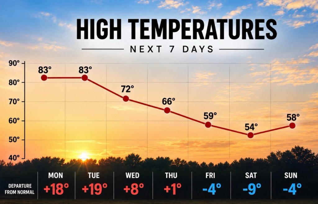
We are nearing the end of our stretch of beautiful fall weather, and we will likely see our last trip into the low-to-mid 80s over the next day or two. By midweek, things get more active, and we begin to cool down.
Rain chances pick up Tuesday night and continue into Friday morning. If everything falls into place, a few snowflakes could even mix in from Thursday night into Friday morning (though that is unlikely).
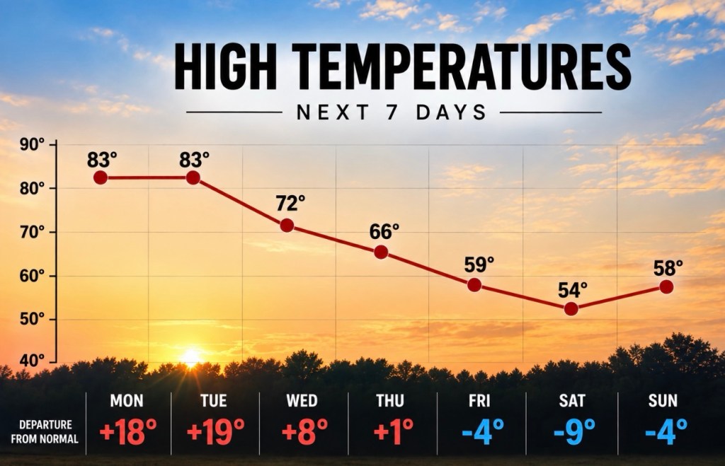
Our highs on Friday and Saturday will likely be in the 50s, and the lows could fall into the 30s each morning. Confidence in temps falling to near or below freezing is low, as is confidence in any snowflakes or hard freeze(s) late next week.
Rain totals from Wednesday through Friday evening look to be around 1-2”, though with that being spread out over roughly 72 hours, it won’t feel like much. Model agreement is about as good as my 5 and 9 year old agreeing on what TV show to watch, but I am confident we will see some rain.
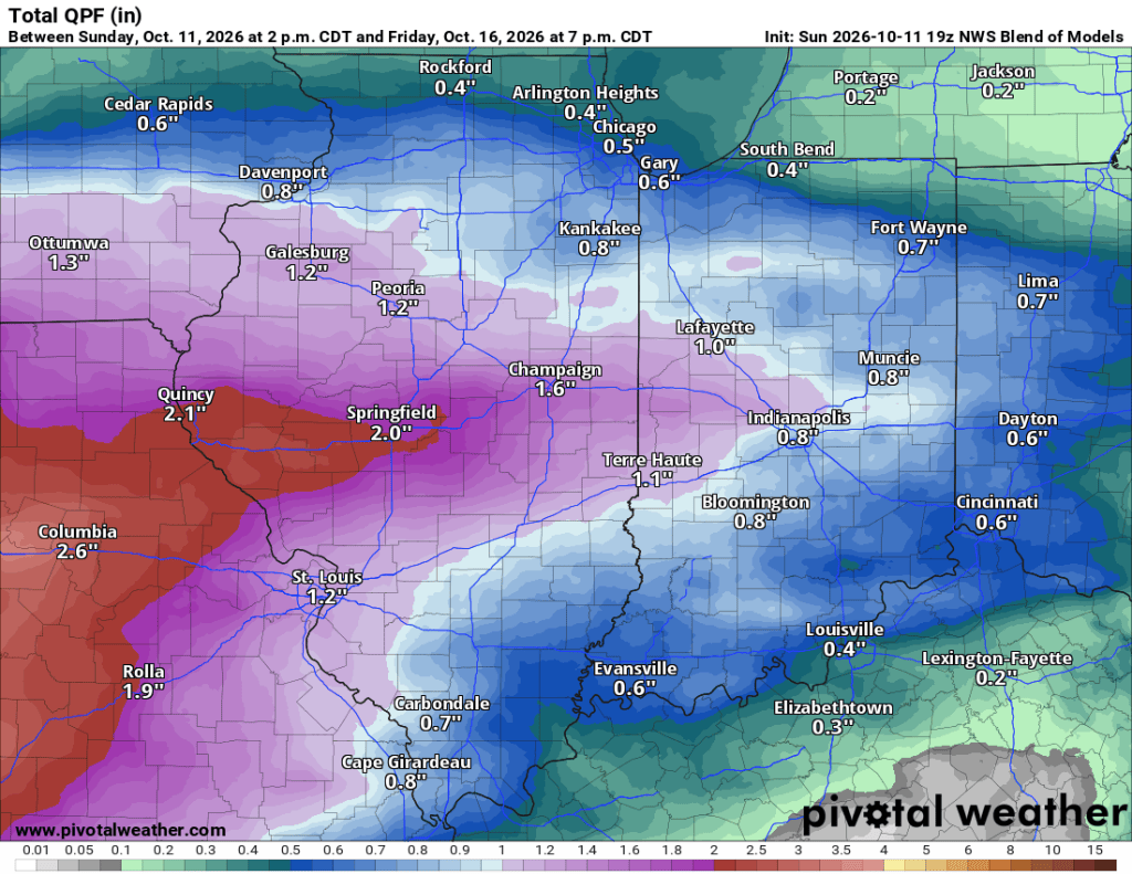
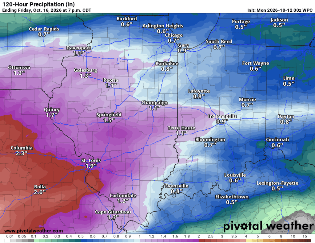
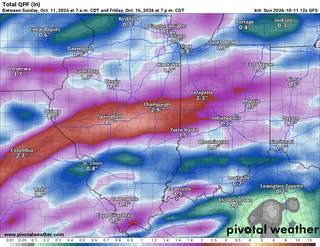
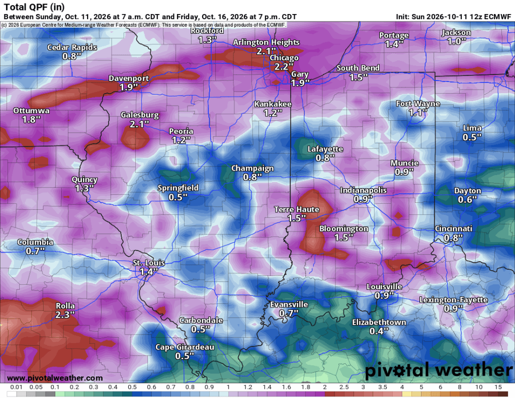
Timing is fairly consistent, but totals in Elkhart County range from 0.25” to 1.5” between Tuesday night and 8 PM Friday. There is a slight chance of lingering showers Saturday, and it will stay cool next weekend, but temperatures should bounce back to seasonable levels, with highs mainly in the 60s and lows in the 40s.
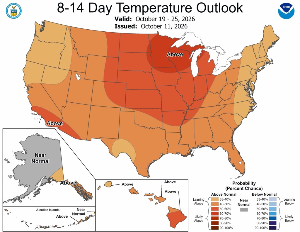
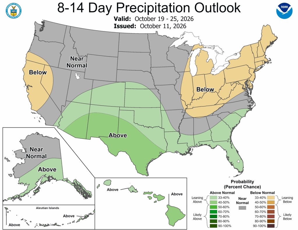
Early indications for Halloween 2026 point to relatively warmer, drier conditions, but it is far too early for specifics. Today’s 8-14 day outlook stretches into late October and paints a warmer-than-normal, drier picture locally.
Enjoy the warmth over the next 36-48 hours—it truly could be our last time in the 80s until next spring. Have a great week!


Leave a Reply